Conditions updated: Jul 17, 2026
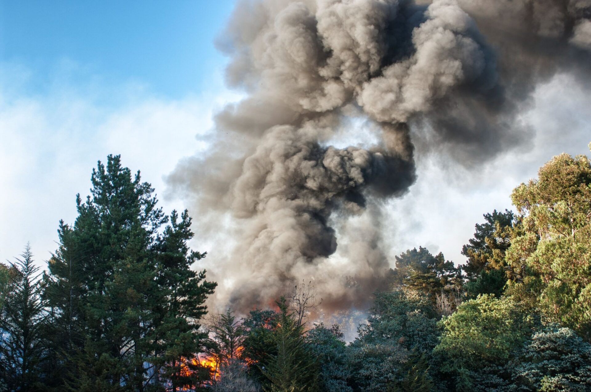
Canadian and U.S. wildfires are sending smoke across large parts of North America, leading to air quality alerts from the Upper Midwest to portions of the Northeast while smoke continues to affect some Western travel corridors. But a smoky campground doesn’t necessarily mean a wildfire is burning nearby; smoke can travel hundreds or even thousands of miles before reaching your destination.
Before you hit the road or relocate to your next campsite, check both current air quality and nearby fire activity. A quick look at wildfire smoke maps can help you decide whether to continue as planned, delay your drive, or choose a campground with cleaner air.
If you’re a Campendium PRO member, you can also turn on the Wildfire Smoke map overlay while planning your trip. As with any wildfire event, confirm current conditions through official sources before making travel decisions.
TL;DR
- Smoke can travel far from the fires producing it, so haze at a campground does not automatically mean the campground is near an active wildfire.
- Check the AQI, smoke forecast, active incidents, road conditions, and campground notices before beginning each driving day.
- Reroute or delay when air quality is unhealthy for your travel party, visibility is deteriorating, or an active incident threatens roads or campgrounds.
Where Wildfire Smoke Is Affecting RV Travel Right Now
Wildfire smoke is affecting several parts of the United States, but conditions vary from one region to the next. Air-quality alerts can change within hours as wind direction shifts, so use the summaries below as a starting point and verify current conditions before you travel.
- Upper Midwest: The Upper Midwest continues to experience some of the most widespread smoke impacts. Smoke from Canadian wildfires, along with active fires in northern Minnesota, has contributed to elevated air quality index (AQI) readings and periods of reduced visibility in parts of the region.
- Great Lakes: Smoke is drifting across portions of the Great Lakes, with forecasts indicating that conditions may fluctuate as weather systems move through the region. Some travelers may encounter hazy skies, while others could see temporary increases in fine-particle pollution depending on local wind patterns.
- Northeast and Mid-Atlantic: Smoke has reached parts of the Northeast and Mid-Atlantic, prompting air-quality alerts in several areas. While many campgrounds remain open, surface smoke may reduce air quality even when no nearby wildfire is present.
- Western Fire areas: In parts of the West, RVers may encounter both wildfire smoke and the direct effects of nearby fire activity. Conditions can include temporary road closures, campground restrictions, evacuation notices, and changing fire restrictions alongside degraded air quality.
What RVers should know
Current forecasts indicate that smoke may continue affecting parts of the Upper Midwest, Great Lakes, and Northeast through the weekend, although the exact footprint will depend on changing wind patterns and weather systems. Meanwhile, firefighters continue responding to dozens of large wildfires across several Western states and parts of the Upper Midwest.
This Is a Widespread Smoke Event, Not One Fire Covering the Country
The smoke affecting much of the U.S. isn’t coming from a single wildfire. Instead, it’s the result of smoke from hundreds of active fires being carried by upper-level winds and combining into broad plumes that stretch across multiple states and provinces. As those winds shift, the smoke can move quickly, causing air quality to improve in one area while worsening somewhere else.
That means poor air quality doesn’t always indicate a nearby wildfire. A campground can have hazy skies, the smell of smoke, and elevated AQI even when the closest active fire is hundreds of miles away. Likewise, a campground near an active wildfire may have relatively clear skies for a time if the wind is pushing smoke in another direction.
Smoke nearby vs. a fire nearby
- Smoke-only concern: Air quality is poor, visibility may be reduced, and you might notice a smoky smell or hazy skies. However, there are no nearby wildfire incidents affecting campground operations, roads, or access.
- Direct wildfire concern: An active wildfire is close to your campground or travel route. Depending on the situation, this can lead to road closures, evacuation orders, campground closures, fire restrictions, or rapidly changing access conditions.
Check These Maps Before You Drive
No single map tells the whole story. Before you head to your next campground, use a combination of air-quality, wildfire, and local advisory sources. Together, they can help you understand what you’re breathing, whether a fire is nearby, and if your route is still open.
- AirNow Fire and Smoke Map: This should be your first stop before traveling. Developed through a partnership that includes the U.S. Environmental Protection Agency (EPA) and the U.S. Forest Service, it combines multiple data layers into a single interactive map.
- InciWeb and NIFC: InciWeb provides official updates for major wildfire incidents, including fire location, containment progress, evacuation information, road closures, and other incident updates that could affect your trip. The National Interagency Fire Center (NIFC) publishes a daily national fire summary, giving travelers a broader picture of wildfire activity across the country.
- State and local air-quality agencies: Federal maps provide an excellent overview, but local agencies often publish more detailed information for individual communities. Their updates can be especially useful when deciding whether to continue to a specific campground instead of changing plans for an entire region.
- Campendium’s smoke and air quality overlay: If you’re using Campendium PRO, you can compare smoke conditions with its Smoke Map feature without switching between multiple maps.
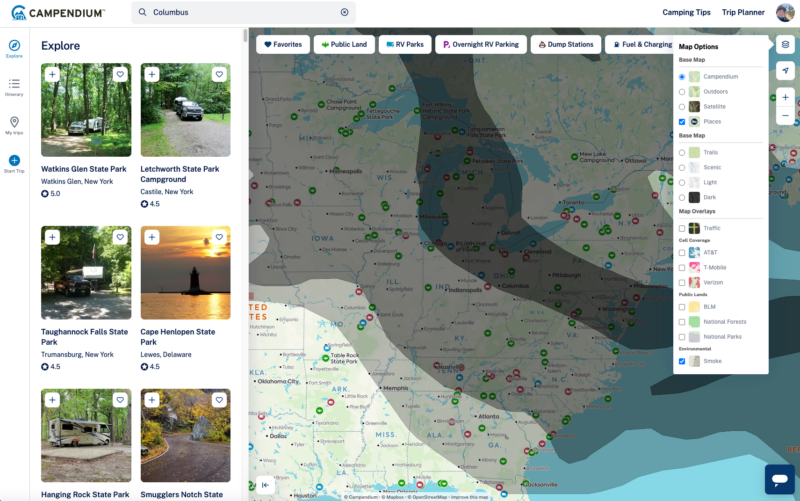
Here’s a simple workflow you can use:
- Open Campendium’s Trip Planner and click the map layers icon at the top right of the map.
- Turn on the Smoke Overlay.
- Compare current smoke conditions with your planned route and campground stops.
- If your route passes through a smoky corridor, look for alternative campgrounds in areas with better air quality.
- Before making a final decision, verify conditions with AirNow, InciWeb, and any applicable local land managers or transportation agencies.
Should You Keep Driving, Delay, or Reroute?
The right decision depends on several factors, including air quality, visibility, nearby fire activity, your travel party, and whether your RV can provide cleaner indoor air while you’re on the road. Before leaving camp each morning, work through these questions.
Continue with caution when
You can usually stay on your travel plan if conditions are stable and you’re prepared for changing smoke levels.
Continue with caution when:
- AQI remains at an acceptable level for everyone traveling with you.
- Visibility is good enough for normal driving.
- There are no active wildfire incidents threatening your planned route or destination.
- Forecasts indicate air quality is expected to improve or remain stable during your travel window.
- Your RV provides a reasonably sealed interior, allowing you to run the air conditioner on recirculation with a clean cabin filter if smoke increases.
Even then, continue monitoring conditions during fuel stops and before arriving at your campground. Smoke can shift much faster than a day’s driving schedule.
Delay the driving day when
Sometimes waiting a few hours is the safest and easiest solution.
Consider delaying your departure if:
- Forecasts show AQI improving later in the day.
- Morning smoke is reducing visibility, but changing weather is expected to clear conditions.
- Someone in your travel party (e.g., children, older adults, pets, or anyone with heart or lung conditions) is beginning to experience smoke-related symptoms.
- Air quality at your destination is currently worse than where you’re parked.
- Smoke forecasts or incident information remain uncertain and local agencies are still updating conditions.
Reroute or relocate when
Sometimes changing plans is the safest option.
Look for another destination if:
- AQI reaches Unhealthy, Very Unhealthy, or Hazardous levels for anyone in your travel party.
- Forecasts indicate heavy smoke will remain over your destination for an extended period.
- Visibility has deteriorated enough to make driving unsafe, especially if you’re towing or driving a large motorhome.
- An active wildfire is threatening your planned route or campground, or local authorities have issued closures, fire restrictions, or evacuation notices.
- Your RV cannot maintain reasonably clean indoor air because of poor sealing or limited filtration.
Quick decision check: Check the AQI → Check for nearby wildfire incidents → Check visibility, road closures, and campground status → Consider everyone traveling with you—including pets → Decide whether to stay, delay, or reroute
Signs That Mean It’s Time to Stop and Reassess
Wildfire smoke can affect people differently depending on air quality, how long they’re exposed, and whether they have underlying health conditions. According to the U.S. Environmental Protection Agency (EPA) and the Centers for Disease Control and Prevention (CDC), common symptoms of smoke exposure can include:
- Persistent coughing.
- Shortness of breath.
- Wheezing.
- Chest discomfort.
- Headache.
- Dizziness.
- Unusual fatigue.
- Eye, nose, or throat irritation.
If anyone in your travel party develops symptoms that worsen or don’t improve after moving to cleaner air, reduce outdoor activity and consider delaying your trip until conditions improve. Seek prompt medical care if someone experiences severe or worsening symptoms, such as significant difficulty breathing or persistent chest pain.
Don’t forget about pets
Wildfire smoke can affect pets, too. Watch for coughing, difficulty breathing, unusual fatigue, or a reluctance to walk, play, or eat.
If your pet develops these symptoms, move them to cleaner air as soon as possible and contact your veterinarian for guidance. During periods of poor air quality, keep outdoor exercise and bathroom breaks as short as practical.
Build a Backup Route Before Conditions Change
Wildfire smoke can change your plans with little warning. Instead of relying on a single reservation, build flexibility into your itinerary before you leave. Having a few alternatives ready can save you from scrambling for a campsite if smoke, poor visibility, or a nearby wildfire affects your destination.
Start by saving two or three alternate campgrounds in different directions from your primary destination. If your backup is only a few miles away, it may still be under the same smoke plume. Looking a little farther afield gives you a better chance of finding cleaner air if conditions deteriorate.
As you compare options, don’t just check the forecast for your destination. Look at the current AQI where you are, along your planned route, and at each potential campground. A route with good air quality can still lead to a destination that’s experiencing unhealthy conditions, and vice versa.
Recent campground reviews can also help you make a better backup plan. Look for comments about current road access, campground conditions, power availability if you’ll need to run your air conditioner, and reliable cell service for checking updated forecasts and emergency alerts while you’re on the road.
Check the Campendium map for campgrounds outside the current smoke corridor, then save at least two alternatives before your next driving day. If you’re a Campendium PRO member, turn on the Smoke and Air Quality Overlay to compare current air-quality conditions with your planned route and campgrounds before you hit the road.
Frequently Asked Questions
It depends on the AQI, exposure time, the health of everyone traveling, visibility, nearby fire activity, and whether the RV can maintain cleaner indoor air. Check live conditions and local guidance before continuing.
AQI above 100 requires extra caution for sensitive groups, while readings above 150 are unhealthy for everyone. Tent campers may need to change plans sooner because they lack filtered indoor space.
Light or moderate smoke may not require rerouting, but dense smoke can reduce visibility and create unhealthy exposure. Slow down, use headlights as appropriate, and stop or reroute when visibility becomes unsafe.
It may reduce exposure when windows and vents are closed and indoor air is filtered, but an RV is not airtight. Smoke can still enter through doors, vents, seals, and HVAC systems.
Check before departure, during fuel or rest stops, and before arriving at the destination. Conditions may change within hours as winds shift.
Check Conditions Again Before Your Next Stop
Wildfire smoke can change dramatically in just a few hours. A campground with clear skies this morning could be under an air-quality alert by the afternoon, while another destination may improve as winds shift. That’s why it’s important to check current conditions before every driving day, not just when you first plan your trip.
As you travel, compare conditions at your current location, along your route, and at your destination, and keep a few alternative campgrounds ready in case you need to adjust your plans. A few minutes of planning can make for a safer, more comfortable trip.
Ready to plan your next stop? Open the Campendium map to search for campgrounds outside the current smoke corridor. Better yet, get a Campendium PRO membership, then turn on the Smoke and Air Quality Overlay to see how changing conditions intersect with your planned route before you hit the road.